The Navigatus weather reporting system is an innovative solution to providing pilots, air traffic control and other aviation professionals with a rich real time picture of the weather situation in the vicinity of an aerodrome. Developed for the challenging conditions in the Southern Alps of New Zealand, real time data continually processed to provide information including wind speed and direction, as well as trends and an indication of turbulence and wind-shear to pilots and ground staff through a web portal or mobile app, or via an operator’s own systems direct to the flight deck.
Why NavMet?
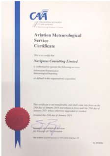
 Following notable investment and extensive development and testing by Navigatus and with oversight and scrutiny by the NZ CAA, the system is certified under NZ CAR Part 174. Navigatus is proud to be the only private company to have gained such certification – and one of only a few to hold similar certification internationally.
Meteorological modelling has advanced significantly in recent times and there are now many channels by which weather information can be accessed. However, at a local level these models routinely give misleading and hence potentially dangerous information.
Conversely, the ease of setting up simple consumer ‘weather stations’ means that some unattended aerodromes and GA pilots are putting themselves at risk of planning based on uncertain and frequently erroneous data, but also running afoul of regulations that required aviation organisations and aviators to only use Meteorological from reliable and certified sources.
The Service
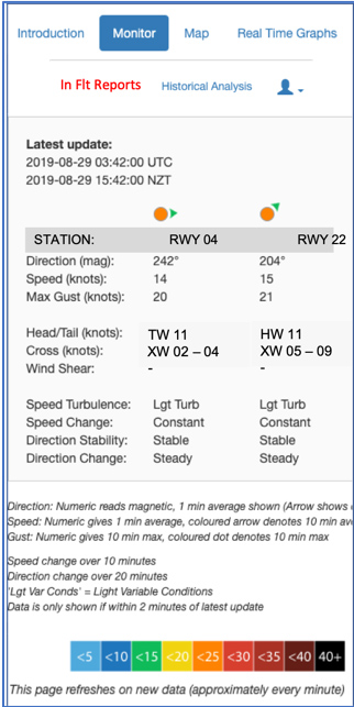
The service is predicated on giving operational aviators the best available certified ‘actual’ meteorological information in real-time together with insights targeting day-of-ops together with historical information to aid training and schedule management. Use of advanced algorithms enable a rich meteorological picture (e.g. trends in direction, speed and turbulence) to be presented to pilots in real-time thus enabling improved prediction and pre-approach planning. Further information such as the instantaneous display of cross wind and head / tail wind components helps reduce pilot workload, while historical information such as wind roses and preferred runway statistics gives further insight into local conditions and adds further operational value.
A customer-centric (pilot / flight-planner) mind set underpinned all aspects of the design of the service and considerable input was sought and obtained during development of the system and services.
The system is designed to be usable at any aerodrome but clearly has greatest value at aerodromes with at times challenging local conditions and also for unattended fields.
While the minimum system would consist of one weather station feeding a web enabled hand held device and desk top applications, a two-station set up is considered optimum for most small aerodromes (one for each runway threshold). However, more challenging aerodromes and operating surfaces will benefit from additional off-aerodrome stations to also give pilots information on conditions such as expected approach path turbulence, cross wind and wind-shear.
Example auto-update smart-phone display. Note auto cross wind and head wind read outs.


For further information, please contact:
Geraint Bermingham
+64 21 88 44 25
geraint@navigatus.aero
